droneroute
Vibe codedI fly a DJI drone, and I wanted my own tool to plan the routes. The idea was simple: run it on my own machine, lay out the flight in 3D, and keep my data to myself instead of handing it to someone else’s cloud. The apps out there either cost money, only work in one place, or make you tap the whole route into a tiny phone screen while you stand in a field.
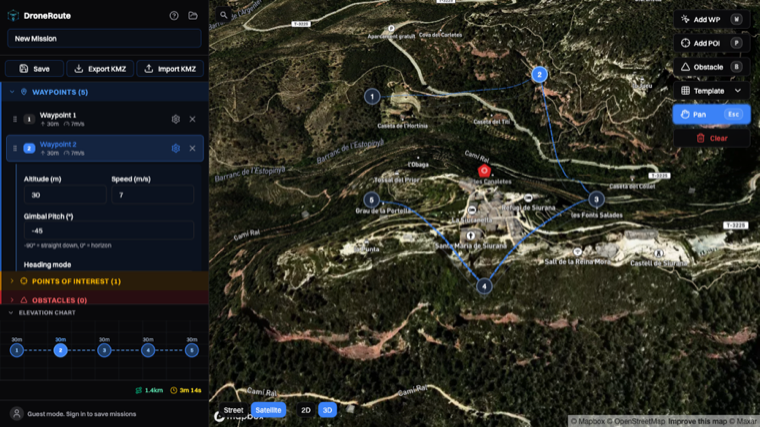
So I built DroneRoute. You click on the map to add waypoints and points of interest, then set the height, speed, camera angle and direction for each one, and the app draws the path the drone will fly. You can switch to a 3D view to see how the route sits against the hills and buildings. When you point the camera at a point of interest, it works out the right angle for you. There are also a few ready-made shapes, like circles, grids and wall scans, so you don’t have to place every point by hand.
When you are done, it saves a KMZ file your drone can read. You can send it
straight to the controller over USB with npx droneroute, or open it in the
official app. It runs on your own machine, or your own server if you like, so
your flight plans never leave your hands.
It works with the drones I could get hold of or find the details for: M300 and M350 RTK, M30 and M30T, the Mavic 3 Enterprise models and the Mini 4 Pro.
Demo
There is a live demo if you want to try it without installing anything.